The U.S. military achieves real-time visibility of trucks carrying military supplies in the Middle East
[ad_1]
The US military has approximately 365 trucks responsible for carrying various military supplies (uniforms, computers, medicines, etc.) from Jordan, Dubai, and Kuwait to the Iraqi theater. The military now uses a set of remote tracking solutions implemented by asset management system provider Impeva Labs and logistics provider Agility to achieve real-time monitoring of these trucks.
According to Mark Young, Vice Chairman of Agility, a defense contractor hired by the US Army Materials Command adopted this solution. Young is responsible for the development of strategies for defense and government service operations. The plan is part of the Military Logistics Privatization Expansion Project (LOGCAP). LOGCAP proposes to use private contractors to support the U.S. military in the mission of the Department of Defense. The contractor is a client of Agility, and Young declined to name it.
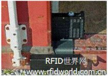
This solution uses Impeva equipment Global Sentinel Unit (GSU). The GSU is installed on the truck and acts like an active RFID tag, sending its unique ID code and GPS data to identify the vehicle and its location. However, instead of communicating with RFID readers, GSU sends data through a global satellite and multi-band cellular network.

GSU
GSU can also store the cargo list of each truck. The GSU is battery powered and contains a GPS receiver and satellite and cellular modem. The device can program more than 40 custom geographic areas. If the GSU leaves these areas, the device initiates communication, and the military can query the device at any time.
The military also plans to add Impeva Labs’ remote sensing equipment (RSU) to this set of programs. The RSU can also be used as an active RFID tag to collect data from wired or wireless sensors, including temperature sensors. GSU and RSU communicate with each other over the 2.4 GHz radio frequency. At present, the military only uses the GSU to remotely monitor and track the location of the truck, but the military has planned to install the RSU in the trailer of the vehicle to collect the status information of the truck and the cargo carried. For example, RSU can collect temperature data to ensure that goods, such as medicines that require refrigeration, are kept at the proper temperature during transportation. If the temperature fluctuation exceeds a predetermined value, RSU will send a report.
GSU transfers the data to a server located in the Impeva Labs data center in the United States. The WEB software running on the server processes and stores all the data collected by GSU. All cargo-related data and continuous GPS position reports are encrypted before being sent via satellite or cellular connections.
The U.S. military uses network software to securely obtain this information. By entering the serial code of a specific truck, the military can determine the location of the vehicle and the materials on the truck, and issue relevant commands in real time.
With more precise visibility, the military understands the arrival time of the goods and the materials that need to be ordered, ensuring that munitions will not run out and preventing inventory. “This allows us and our contractors to optimize the supply chain. By understanding the specific location and type of materials, the military will not re-order similar materials. In addition, this plan also helps the military avoid material loss or material loss caused by theft.” If munitions are hijacked, we will pinpoint the location of the truck and track it down. ”
[ad_2]


