Xiamen RFID Intelligent Transportation System Application
[ad_1]
1. Project background
Xiamen is located in the center of the Golden Triangle in southern Fujian. The main urban area of Xiamen Island is connected to the surrounding area through the Fourth Bridge (Haicang Bridge, Xinglin Bridge, Xiamen Bridge, Jimei Bridge) and a tunnel, and the external transportation is relatively simple. The main roads on the island are concentrated around Yundang Lake. The road network in the central area of the island consists of several main road sections, Hubin North Road, Hubin South Road, Jiahe Road, Hubin West Road, Hubin Middle Road, Hubin East Road, Lujiang Road, Xiahe These main roads are connected to each other to form the road network structure in the central area of Xiamen Island.
As of the end of 2010, the number of motor vehicles in Xiamen reached 725,000, an increase of 12.5% over the previous year. Among them, private cars increased by 60,000, and the number of private cars increased by 31% in the previous year to 291,000. The rapid growth of motor vehicles As a result, traffic congestion has become increasingly serious, road land area has increased, parking supply is tight, and the urban environment has deteriorated. Urban traffic demand has continued to grow rapidly.
Xiamen City has built a rapid transit system. The rapid transit line has largely alleviated the city’s traffic congestion. At the same time, Xiamen is actively promoting the construction of rail transit, serving the city’s internal travel together with conventional buses and rapid transit. Traffic problems in the urban center area of Xiamen Island are still significant. Traffic congestion, disorder, and safety issues all need to be resolved by high-tech management methods. The use of advanced intelligent traffic management methods to manage and control the traffic on Xiamen Island, combined with the coordination of the existing rapid transit system and the rail transit under planning and construction, will greatly improve the traffic situation in Xiamen.
2. Project purpose
The overall goal of Xiamen’s intelligent traffic management system is to buildRFIDBased on information collection, it integrates various scientific and technological management methods and functions such as command and dispatch, traffic control, traffic guidance, emergency guarantee, traffic violation management, traffic vehicle management, and social information services, and integrates advanced information technology and data communication technology. , Electronic technology, control technology, system integration technology and computer network technology and other systems are applied to the entire traffic management system, built in Xiamen, and functioning in all directions, accurate, real-time, and efficient intelligentization that meets the actual needs of Xiamen’s traffic management Traffic command and dispatch control system.
Eventually realize the modernization of traffic command, digital management, and information networking, and realize an orderly, safe, unobstructed, economical, and environmentally friendly road traffic network system.
Three, system design
Road traffic information collection is the basis for the realization of an intelligent traffic control system. There are many means and equipment for realizing traffic information collection, each with its own advantages and disadvantages.The use of radio frequency acquisition to achieve traffic information acquisition is the use of radio frequency technologysmart transportationOne aspect of application has many advantages, and it is also the latest scientific and technological application of information technology in the field of modern transportation. The principle is to digitally process the basic information and related materials of the vehicle, and store them in the electronic tag configured on the car. Through the base station equipment unit installed on the roadside, the vehicle can be identified, Statistics and supervision, through calculation to realize the detection of road vehicle flow, and at the same time collect the location information of several base stations on the road section, combined with GIS geographic information technology, obtain the road section driving speed and journey time of the vehicle through scientific algorithm calculation, and then combine with the central control The processing of the platform completes the traffic management services required by the managers, thereby building a large-scale intelligent transportation comprehensive traffic information service technology platform covering the urban area of Xiamen City, so that the management of vehicles and road traffic management can be informatized and intelligent. stage.
At present, more than 300,000 local motor vehicles and more than 30,000 foreign motor vehicles that have been driving in Xiamen city for a long time have been equipped with electronic tags (also known as “Xiamen road bridge cards”), so there are It provides the unique basic conditions for the implementation of the road traffic information radio frequency acquisition and processing system.
The whole system structure includes four parts:
RFID traffic information collection
Traffic information data fusion and traffic state information extraction
Traffic status information release
Traffic guidance release system
At the same time, Xiamen City is also building a high-definition traffic flow monitoring and video monitoring system, which is not only a supplement to radio frequency traffic flow monitoring, but also provides tactical traffic flow information for the intersection signal control system. At the same time, the system also takes into account the illegal capture function. Through the high-definition network camera with intelligent analysis function, it can automatically detect and capture illegal behaviors such as road changes and reverse directions, fully achieving multiple functions in one machine.
Four, related equipment
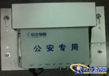
Reader: CTU6861

Antenna: 12dbi

Label: Ceramic Fragile Label

[ad_2]


