[ad_1]
Foreword:
The client of XXXX primary school hopes to expand the home-school-to-safety SMS platform to have the function of locating regional intersections and road sections, and expand the monitoring area to the main roads and important intersections in the city, so that students can be identified by road monitoring after leaving school. Guardians and managers provide personnel paths and regional location data, and send them through the SMS platform. They can also query specific regional locations and event information on an integrated management platform. In order to realize the above functions, Boao Company has planned a sustainable and expandable campus security system platform for the mobile company. Boao Company will apply the system on the basis of home-school safe SMS, and use this platform to connect national and The school bus safety and management, which are most concerned by the whole society, are integrated into this system together. While making outstanding contributions to the country, local government and society, it also creates social image and political achievements for mobile companies in addition to economic benefits. Let the real promotion of the system get the support and help of the government, and successfully achieve a win-win situation.
System composition
omnidirectional antenna, directional antenna,Radio frequency transmitting terminalwireless data transmission terminal, identification card, SMS operation platform, network map information query management platform

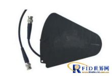
Directional antenna
System function overview
1. Safety SMS and attendance when entering and leaving the school: through long-distance identification, personnel can automatically identify attendance, and send safety SMS through wireless data terminals
2. Road section coverage: According to different road sections and regional conditions, the antenna type is selected in a targeted manner to achieve the coverage of each road section and each intersection. The covered area will run in real time without stopping for 365 days, and will monitor and identify the cards entering the coverage area 24 hours a day.
3. Personnel monitoring: through the network coverage of road sections and intersections, any student wearingidentification cardEntering the monitoring area will be automatically recognized. The identified card information will be uploaded to the platform server at the first time, and the judgment and selection will be made through the server database to confirm the identity information and location information of the person wearing the identification card.
4. Software management network platform: The management platform will appear in the form of a network map, and log in and manage through different management identities. After logging in, you can query all the intersections, paths, and route location information of people, schools, classes, and individuals according to the prescribed authority, as well as the accurate passing time information of different intersections and road sections.
5. Real-time monitoring of personnel paths: Relevant personnel can monitor their children’s travel route information online in real time through mobile phones and computers, and timely help parents to understand their children’s walking routes and positions online in real time through the network platform, and achieve the purpose of safety monitoring.
6. Event-triggered alarm: According to different needs, students can selectively wear identification cards with event-triggered buttons, and the user can trigger the identification-card button to allow parents and managers to get the location information of the event at the first time. (Upgradable) 4. Software management network platform: The management platform will appear in the form of a network map, and log in and manage through different management identities. After logging in, you can query all the intersections, paths, and route location information of people, schools, classes, and individuals according to the prescribed authority, as well as the accurate passing time information of different intersections and road sections.
Features
• Supports tag reading with high concurrency
• High anti-interference • Ultra-low power consumption
• Automatic, long-distance, automatic identification of large traffic, without manual card swiping
• Automated, real-time, easy-to-use communication
• Low cost and maintenance free • Strong scalability
Method to realize:
1. Install access readers and terminal controllers at the gate of the school to realize the judgment of students entering and leaving.
2. Install terminal all-in-one machines around the school and on the main roads of the city to realize the functions of personnel positioning and remote data uploading.
Reader type:
1. A positioning antenna is installed at the gate of the school, which is used to judge the entry and exit of students.
2. The all-in-one machine is installed on the roads around the school, and the antenna type is an omnidirectional high-gain antenna to achieve regional coverage.
Program features:
• Whether it is monitoring the campus gate or the surrounding environment of the campus, it can be easily realized and monitored in real time.
• Realize the coverage from point to surface, no longer limited to point monitoring, and grasp the dynamic information of students in real time.
• Support the periodic reporting of location information to realize the tracking and query functions of the system platform.
• With GIS map, it can realize personnel positioning, real-time monitoring, historical track playback, report output, etc.
[ad_2]