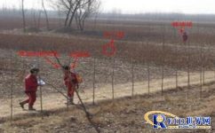
PetroChina applies geophysical safety distance control system
[ad_1]
Project Background:
When blasting exploration work in the field, in order to complete the work of the day as soon as possible, the staff often carry out blasting within a safe distance, so it is easy to cause safety hazards to the staff, and safety supervisors can only randomly check a certain group. Production work, can not fundamentally eliminate such hidden dangers; due to the actual environment of the site, individual shot points are offset due to obstacles, so some shot points are deviated from the theoretical shot points, so that the well position offset in the exploration area is qualified rate is affected, thereby affecting the economics of the company. Based on the above problems, it is necessary to develop a system to solve the problem, ensure safe production and improve the qualified rate of well position deviation.
User background :
CNPC Orient Geophysical Exploration Co., Ltd. (abbreviated as CNPC Orient Geophysical Company, BGP) is the holding company of China National Petroleum Corporation. Orient Geophysics is a multinational enterprise integrating geophysical exploration business as its main business, diversified development, tourism reception and public utilities. Mainly engaged in domestic and foreign land and shallow sea seismic exploration and comprehensive geophysical and geochemical exploration acquisition, processing and interpretation, as well as technology and equipment research and development, product development, technology introduction and product sales related to geophysical (chemical) exploration, domestic and foreign technical engineering contracting and labor services output etc. Run geophysical supervision, tourist hotel services, communications and engineering services, construction engineering and installation, property management, services and operations.
Specific solutions:
According to the customer’s needs, we design the geophysical well gun excitation safety distance control system for the customer, a total of 18 sets, each system has a wellhead station, a control station, a forwarding station and a mobile station, as well as the geophysical positioning engine software. The techniques used are as follows:
(1) High-precision GPS positioning technology:
GPSDifferential positioning is a method of determining the relative position between observation points based on the observation data of two or more receivers. It can use either pseudorange measurement or relative measurement. Generally, the relative measurement value should be used for geodetic survey or engineering survey. relative positioning. The system adopts the positioning method of relative measurement value with relatively high precision.
(2) WSN wireless ranging and communication technology:
WSN stands for wirelesssensorNetwork, he includes two functions:
a) Wireless ranging. The basic principle is to use the round-trip time difference of the signal to measure the distance. Specifically, the time difference between the completion of the signal transmission and the start of receiving the signal is timely, minus the processing time of the chip, and then divided by the transmission speed of the signal in the air medium. The result is Half is distance.
In order to improve the ranging accuracy, the system innovatively adopts the method of multiple round-trip measurements to improve the ranging accuracy.
b) Wireless communication. A small amount of data transfer is possible without compromising ranging accuracy and functionality. This system adopts the communication technology based on WSN to realize the communication between short-distance devices.
(3) Detection of blaster firing: The blaster generates a high voltage of about 400V in a very short period of time to excite the detonator, and the instantaneous high voltage generated at both ends of the blaster is detected by electronic components to detect the blasting signal without affecting the blasting.
(4) Limit blaster firing: cut off and close between the gun line and the blaster by controlling the relay.

Implementation result:
1. Aiming at the problem of shooting at a non-safe distance in the field, this project adopts high-precision GPS positioning technology and modern electronic control technology. Through the control of the blaster, the construction personnel can only achieve the function of shooting at a safe distance, which fundamentally eliminates the need for fire. In order to avoid the safety hazard of firing guns at non-safe distances, the development of the project has improved the HSE management level of the well gun seismic team.
2. By comparing the theoretical wellhead shot point coordinates with the real wellhead shot point coordinates transmitted in real time from the construction site, the well deviation data is calculated, and a well shot deviation monitoring system is developed based on this data, which is timely for the quality monitoring personnel of the earthquake team. The discovery of the shot point problem provided data support.
3. The monitoring system platform can display the working position and operation route of the explosion class in real time, count the cumulative number of shots fired and the number of shots fired on the day, and provide scheduling and decision-making references for production commanders.
4. The field adaptability experiment found that GPS accuracy is better in plain construction than in mountainous areas and construction areas with large sand dunes, and areas with fewer obstacles are better than areas with many obstacles, so the use of well deviation monitoring in plain areas can achieve better results. Effect.
[ad_2]


