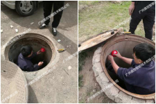
RFID technology manages municipal manhole covers and underground pipelines
[ad_1]
The intelligent management system of municipal underground pipelines in this solution of Chenkong Intelligent uses rfid radio frequency identification technology, sensor technology, geographic information technology, computer network technology and other wireless communication technology and other Internet of things related technologies, through burying rfid underground in urban streets Markers and intelligent gateways are built to form a basic perception network to realize the integrated real-time monitoring and management of the state of municipal manhole covers and the direction of pipelines, timely warning, and command linkage. The construction and application of this system has innovated the management mode of municipal underground pipelines, improved the management process of municipal underground pipelines, and comprehensively improved the level of urban refined management.

1. System function
1. Information management: The identification card installed on the manhole cover can record the location, property rights, contact person, telephone and other attribute information of each manhole cover, and the management department can count the manhole cover information in real time.
2. Real-time positioning: through the software plan, you can view the location and attribute information of the manhole cover and underground pipeline in real time.
3. Marker management: Marker management is used to manage marker information, such as marker identification information, on-site picture editing, GPS coordinate correction, data export, etc.
4. Maintenance records: The maintenance records are mainly used to display the maintenance history records of all the signs in the system, including the embedding of the signs, adding information, etc.
5. Map function: The map function is mainly used to display the coordinate position of the marker on the map, which can easily check the distribution of the pipe network, and make overall planning for inspections and maintenance.
There is a marker display content selection on the top of the map, and you can choose to display the marker coordinates in a certain project individually. Click on the marker on the map with the mouse, and the system will pop up the information box of the marker. Click the marker ID in the information box, and the system page will automatically switch to the detailed page of the label.
6. Project management: Project management is used to manage different pipelines. You can add the project name, project remarks, and set the map display color of the electronic marker under the project on the project editing page.
7. Personnel management: The personnel management function is used to assign the authority of personnel. The administrator has all the functional authority, and the operator can manage the identifier information of different projects according to the respective authority.
8. System setting: The system setting function includes 3 parts of functions, basic information setting, marker template setting and system backup. The marker template is used to set the function fields displayed by the marker. After changing the display fields in the background, the latest field content will be synchronized after the mobile APP connects to the background.
9. Data analysis: According to needs, it can reorganize, summarize and compare a large amount of data in the system from different angles and maintenance, and dig out valuable data that is more conducive to improving the level and efficiency of municipal management.
2. Related software
The detector APP is the marker management software installed in the landmark detector. It can be used in conjunction with the background software to realize the detection, search, data upload, and maintenance of municipal underground markers. Only the simple marker detection function can be realized when the APP is not logged in, and the data upload and download service can be realized after logging in to the server.
The main interface of the APP includes five functional blocks: scanning, maintaining records, landmark management, proximity, and settings. The RSSI and depth value indicator bar is used to display the current embedding depth of the marker and the signal strength of the marker, which can show the information of the underground pipeline more clearly.

3. System advantages
(1) Advanced technology: Perfect integration of RFID wireless radio frequency and intelligent sensing technology to uniformly realize the distribution of municipal underground pipelines in the same area.
(2) Reliable transmission: The unique rfid radio frequency transmission technology is adopted, which has the characteristics of strong penetration, controllable transmission distance, strong anti-attenuation ability, and strong anti-interference ability to ensure effective signal coverage and transmission.
(3) High security: The self-developed built-in encryption protocol ensures stable data interaction in the system and prevents link detection and security.
(4) Accurate judgment: The design of the marker adopts advanced technology, adapts to various environments, has a long service life, and can effectively reduce the number of maintenance.
(5) Simple construction: The appearance design of the marker is suitable for the actual installation environment, and the construction is simple, without laying any cables.
(6) Convenient maintenance: easy to disassemble, firm and reliable after installation.
[ad_2]


