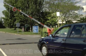
Radio frequency identification and positioning system for three-dimensional bus parking lot in Shanghai World Expo Park
[ad_1]
620)this.style.width=620;” border=0>
Shanghai World Expo Park Asia’s largest three-dimensional bus parking lot radio frequency identification positioning system
1. Introduction to the system
The system mainly adopts Super-ZigBee and i3RFID technology. Active electronic tags are installed on the parked buses, which correspond to the identity of the vehicles one-to-one. Tag readings are installed in the parking building, field passages, auxiliary buildings and main roads of the field. Writer is used as a positioning benchmark for the current location (area) of the vehicle; long-distance beacon readers are installed on the roofs of public transit office buildings and operational business buildings to provide switching signals for wake-up or sleep when vehicles enter and exit the field.
Through the dedicated hardware and software equipped in this project, all the public transportation vehicles in the parking lot can realize timely and accurate detection, recording and communication with regard to their vehicle identity, when and where and other information; at the same time, it is possible to achieve timely and accurate detection, recording and communication of the relevant equipment, Status monitoring of components.
620)this.style.width=620;” border=0>
2. Features
Controlled vehicles: West Valley active electronic tags are fixedly installed on the vehicles.
Parking building: After the vehicle enters the parking building, the positioning system can detect in time which floor each vehicle is on, which up/down ramp, which parking area or car repair area, and avoid detection of entering adjacent areas vehicle. West Valley long-distance tag readers are fixedly installed at the entrances and exits of each parking area, car repair area and up/down ramps, and each vehicle entering and leaving the area is detected by the West Valley active electronic tags.
Gas station: When a vehicle enters a gas station to refuel, it can be determined which station (a certain fuel gun of a certain gas machine) it is refueling. Each refueling machine is equipped with a handheld wireless reader to collect the electronic tag information and refueling station information of the refueling vehicle, and the information is transmitted to the gas station management software to determine the current refueling vehicle and the refueling material, so as to automatically record the current vehicle Information about this refueling.
Accessory buildings and entrances and exits of the site: each vehicle in the car wash, garage, comprehensive garage and other auxiliary buildings can be detected, while avoiding the detection of vehicles driving on adjacent roads. Fixedly install tag readers in these buildings, and detect vehicles entering and leaving the area through electronic tags.
Field road: each vehicle driving or parked on the field road can be detected, and its location on the road can be accurately distinguished. Install tag readers at appropriate positions on both sides of each road in the factory (building walls or lighting poles), and detect vehicles on the road through electronic tags.
Activation unit: The wireless signal of the activation unit covers a range of more than 1500 meters, wakes up the on-board electronic tag that is about to enter the parking lot, and makes the on-board electronic tag leaving the parking lot dormant.
3. System composition
ZigBee electronic tags, M1 radio frequency card electronic tags, ZigBee tag readers (wireless communication), ZigBee tag readers (RS485 communication), ZigBee tag readers (RS485) communication controller, ZigBee information collector, handheld wireless reader Writer, ZigBee label activation unit, M1 radio frequency card issuer, ZigBee label issuer, location information background software.
620)this.style.width=620;” border=0>
4. Technical indicators
1) In the multi-storey garage (parking building), the regional positioning of the bus is carried out, and the positioning accuracy at the entrance of a parking area planned by the parking space marking line is within the range of the parking area.
2) At the entrances and exits of the field and in the auxiliary buildings, the bus vehicles should be located to avoid detecting the vehicles driving on the adjacent passages. The entry/exit can be distinguished at the passage entrances that allow two-way driving in and out.
3) Positioning the state of public transportation vehicles within the range of the traffic road in the field area can accurately distinguish the road on which they are traveling, which can meet the needs of the roadside electronic display to dynamically display personalized information for oncoming vehicles and stop information when the vehicle leaves show.
4) The overall response time of vehicle positioning is less than or equal to 2S.
The background processing software of the vehicle positioning system is an independent software package, which transmits the determined position, time and status information of the electronic tag; in addition, it also includes system maintenance functions: equipment replacement information reset, equipment working status monitoring (including defect alarms) .
[ad_2]


