Forest Cloud Management System
[ad_1]
Construction background
After more than ten years of arduous journey of returning farmland to forests, forestry has entered a situation of comprehensive development, and its management decisions have also entered a new stage, such as forest resource management, forest fire prevention, forest investigation, natural forest protection, wind prevention and sand control, and forest diseases and insect pests. There is an urgent need to adopt new technology to serve its development in prevention and treatment. Based on its own independent technologies such as the Internet of Things, and combining the most advanced technologies in the fields of sensing, cloud computing, cloud storage, and mature GIS systems, Sihai Cloud Networking can help people intuitively manage the forests in the area. The status and development trend are clearly and intuitively expressed in the form of graphs, data tables, etc., and spatial visualization analysis is carried out to realize the integration of data visualization, geographic analysis and practical application, so as to promote the management of forestry on the path of modern sustainable development.

Forest cloud construction
Through the application of Internet of Things, Remote Sensing (RS) technology, cloud computing, mobile Internet, big data, smart earth and other technologies, establish a four-network and one platform such as sky network, ground network, human network, forest network and smart forest platform, with a unified Based on the information on the spatial distribution of forestry resources, it is used for the management of forest resources, wetland resources, desert resources and biodiversity resources. The national forestry data is implemented on the hilltops to provide multi-level forestry resource distribution information from macro to micro. Establish a forest resource monitoring and management system, improve monitoring efficiency, and meet the needs of forestry decision-making and ecological construction for macro-information on forest resources. The system integrates remote sensing image processing, remote sensing information extraction, statistical analysis of results, and information database management, and provides functions such as remote sensing data processing, forest management classification and interpretation, information extraction of pests, illegal logging, and information database management.

System realization function
The system is divided into three layers: the first is the data collection layer, which contains status information, fire and pest illegal logging information, which constitutes the basic database required by the system, and is updated from time to time; the second layer is the system public information platform to realize the status of forest resources Information and forest diagram management; the third layer is the application layer, which provides different user systems according to different business sectors of customers.
1. Establish an auxiliary decision-making support system for forest resources supervision. Based on the monitoring status data of forest resources at all levels, and based on the dynamic change data of forest resources generated during the management of forest rights and logging and utilization, it can realize the status and dynamics of forest resources. Integrated information management.
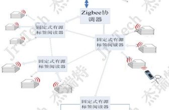
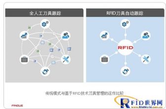
2. Through the application of RFID electronic ID card, we can reduce or even eliminate illegal logging, over-exploitation, excessive excavation, smuggling, reselling and other illegal activities from the root cause. Make full use of radio frequency identification and other technologies to establish a complete forest electronic label system, and combine it with specially designed electronic freight tickets, transportation permits, logging permits, collection permits, quarantine permits, etc., to achieve the production and transportation of timber and wild animal and plant products. The meticulous management of links such as, storage, and sales has greatly improved the level of law enforcement supervision and public service.
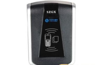
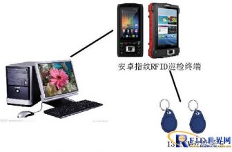
—-Pictures of equipment used: tree electronic tags, forest resource distribution GIS, RFID tablets, handhelds, channel equipment

[ad_2]


